Teletskoe
Teletskoe
The Map Of Teletskoe Lake
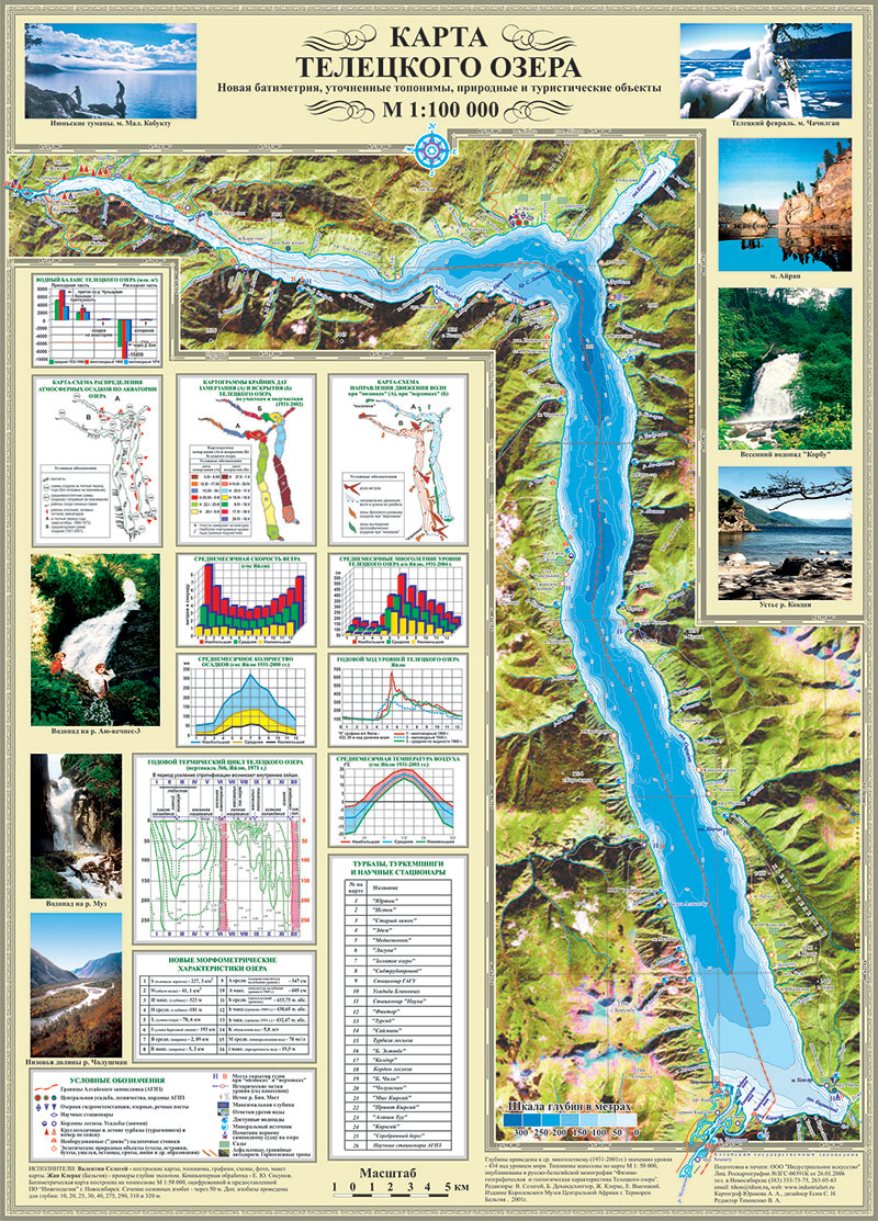
Teletskoe Lake paper map with 3D elevation and bathymetry 1:100 000 scale.
For tourists and proffi – unique amount of information: geography, temperature, wind, precipitation, water balance, etc. in the region of Teletskoe Lake, Mountain Altai.
- Category : Software Development
- Tools: ArcGIS, CorelDraw!
- Scale: 1:100 000